
Cargando...
Troba
visualització
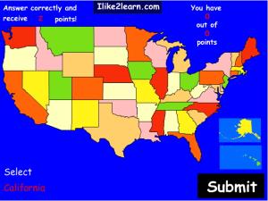
Learn the names and map locations of all the states in the United States with this interactive quiz.
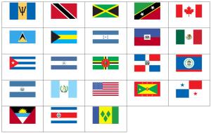
Can you name the flags of North America?
Try to guess where each given capital of eastern US state is located on the map.
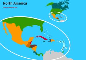
Would you know to locate the countries of North America you are asked about? You must point out each exact location on the map.Es un mapa de la colección EastDock Media.

Try to guess where each given capital of western US state is located on the map.
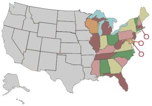
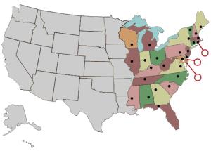
Guess where each given state of eastern United States is located on the map.
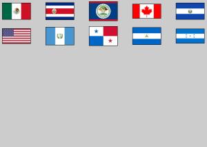
Click on the flag of each given country of North and Central America.
There are 14 US cities, with an urban area population of 20,000 or more, on its land border. The first 4 are adjacent to Canada, the remaining 10 adjoin Mexico. How many can you name?
It is an educatio ...
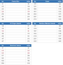
Which countries are closest to each of the US's five inhabited territories (Puerto Rico, US Virgin Islands, Guam, Northern Mariana Islands and American Samoa)? Excludes uninhabited offshore islands.
It ...
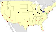
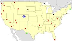
See if you can correctly guess each highlighted American city.
It is an educational content by JetPunk, site that contains a wide variety of quizzes.
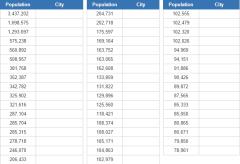
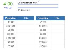
How many of America's biggest cities you can name, based on the 1900 census?
It is an educational content by JetPunk, site that contains a wide variety of quizzes.
Click the name of each highlighted national park on the map.
It is an educational content by JetPunk, site that contains a wide variety of quizzes.
Afegir a Didactalia Arrastra el botón a la barra de marcadores del navegador y comparte tus contenidos preferidos. Más info...


